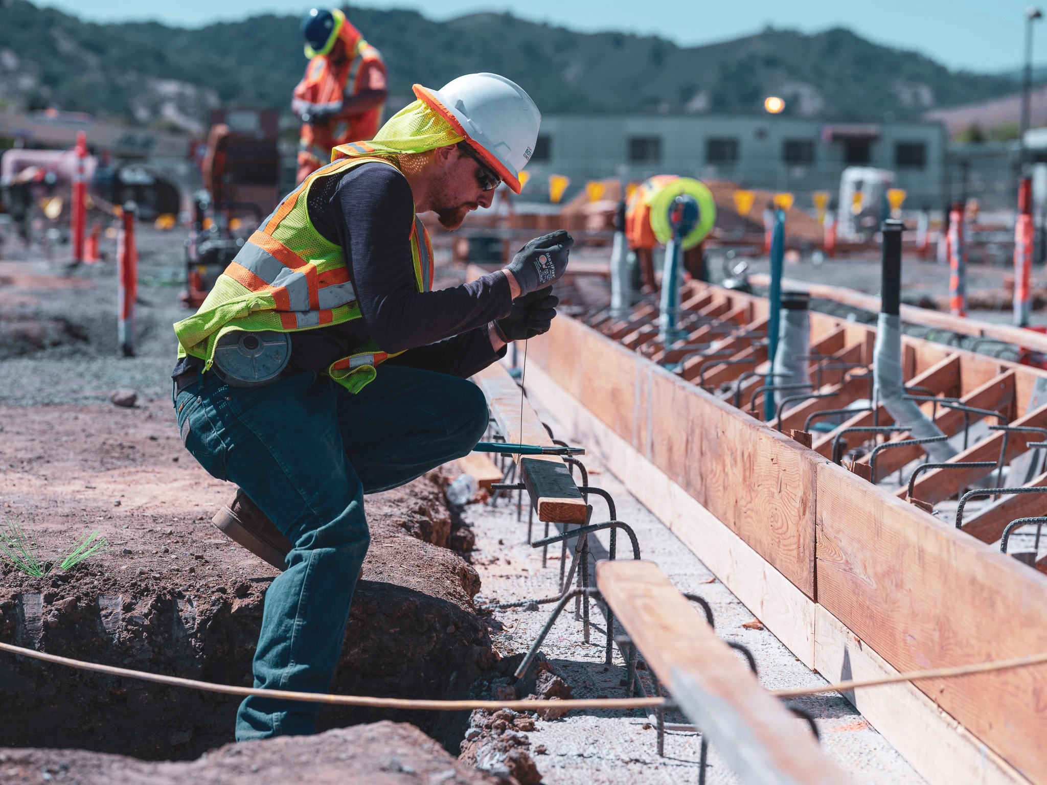
What is reality capture and why should you invest in it
.svg)
Quick Summary
You may have heard the term “reality capture” before – but what does it mean and why are industry leaders from the construction and oil and gas industries, as well as non-profit organizations, adopting it?
Reality capture is an umbrella term used to describe technologies that are used to capture and record the physical world as digital data. This data can include anything from pictures and videos to 360-degree panoramas and advanced LiDAR scans. Companies can then use this data to build maps and create 3D models that allow them to remotely perform QA inspections, analyze build processes, manage wildlife protection projects and much more.
Instead of relying on the traditional method of manual measurement and analysis, reality capture allows you to utilize smart technology to create a complete digital picture of what you’re working on. Companies across a wide breadth of industries are realizing a savings in time, money and resources by deploying their own reality capture programs.
While reality capture technologies have been around for decades, recent advances in technology have made them more accessible and cost-effective than ever before.
What is reality capture?
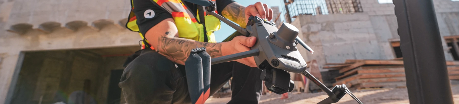
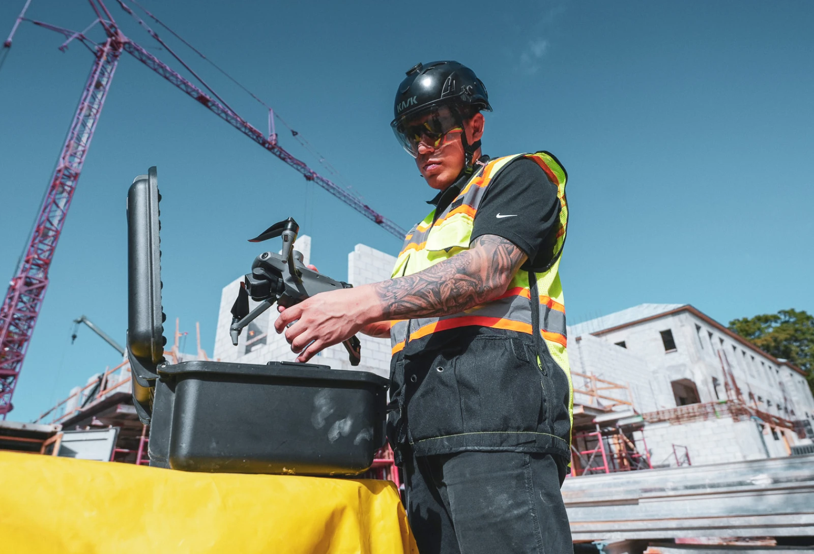
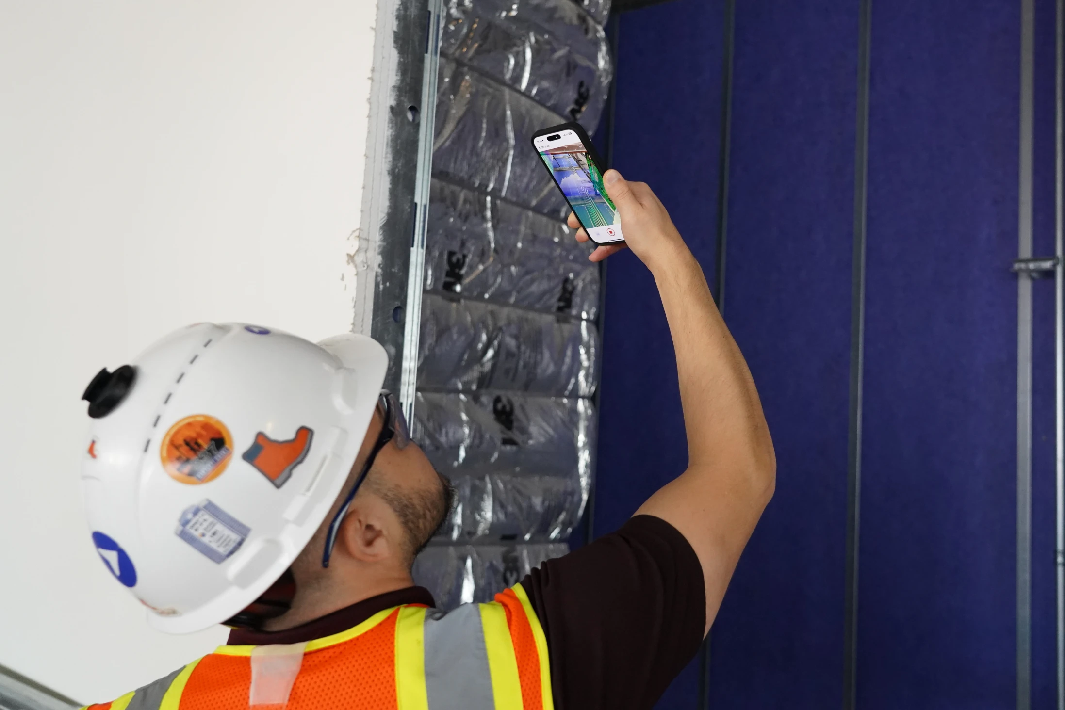
Reality capture digitally documents and replicates physical sites using 3D scanning, photogrammetry, LiDAR and drones. You capture high-resolution data of real-world conditions and convert it into digital models for analysis and decision-making.
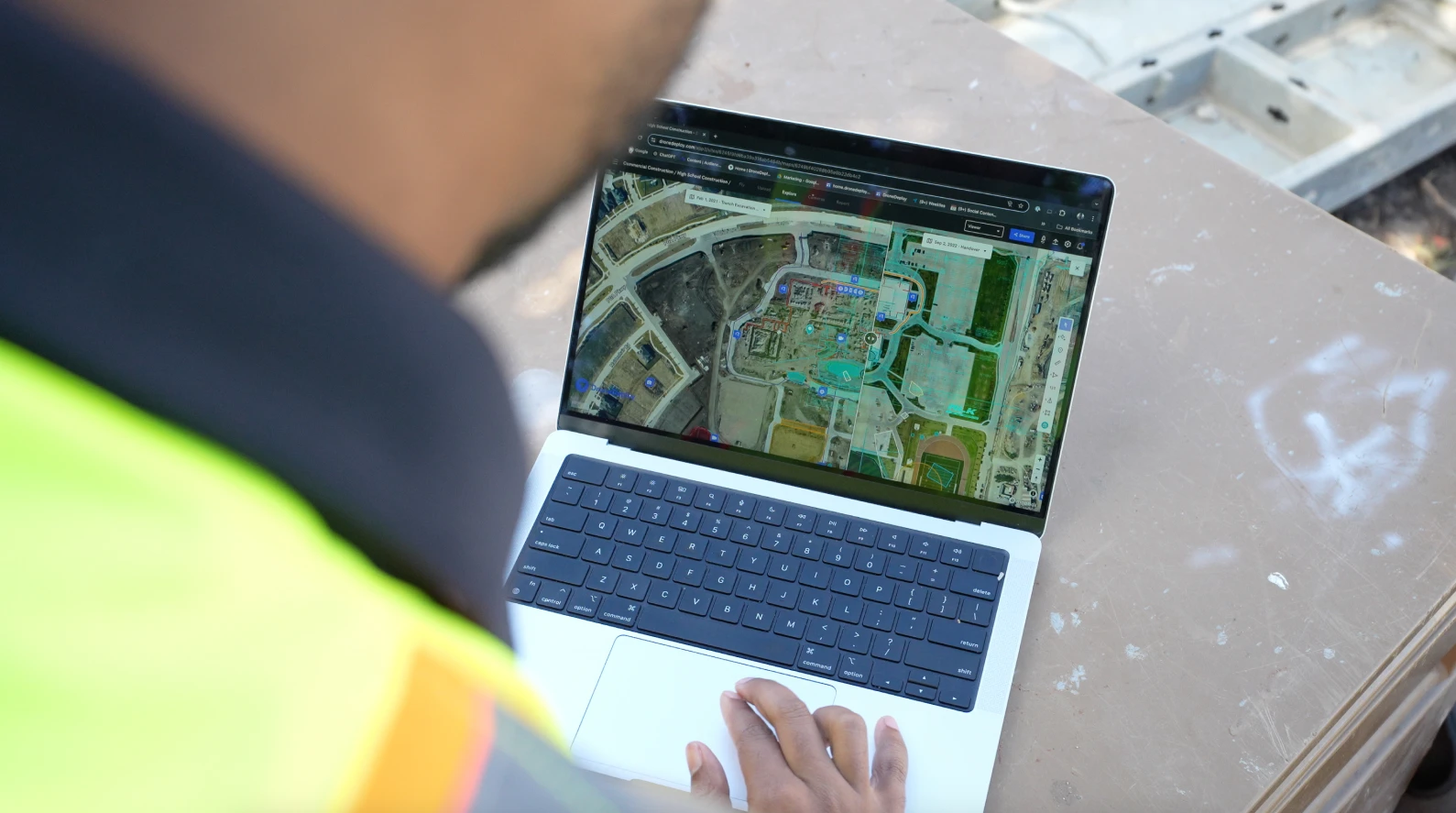
The process creates "digital twins" – precise digital replicas of your construction sites that let you inspect remotely, track progress and coordinate with stakeholders without burning time on site visits. These digital models give you a virtual representation of real conditions accessible from anywhere.
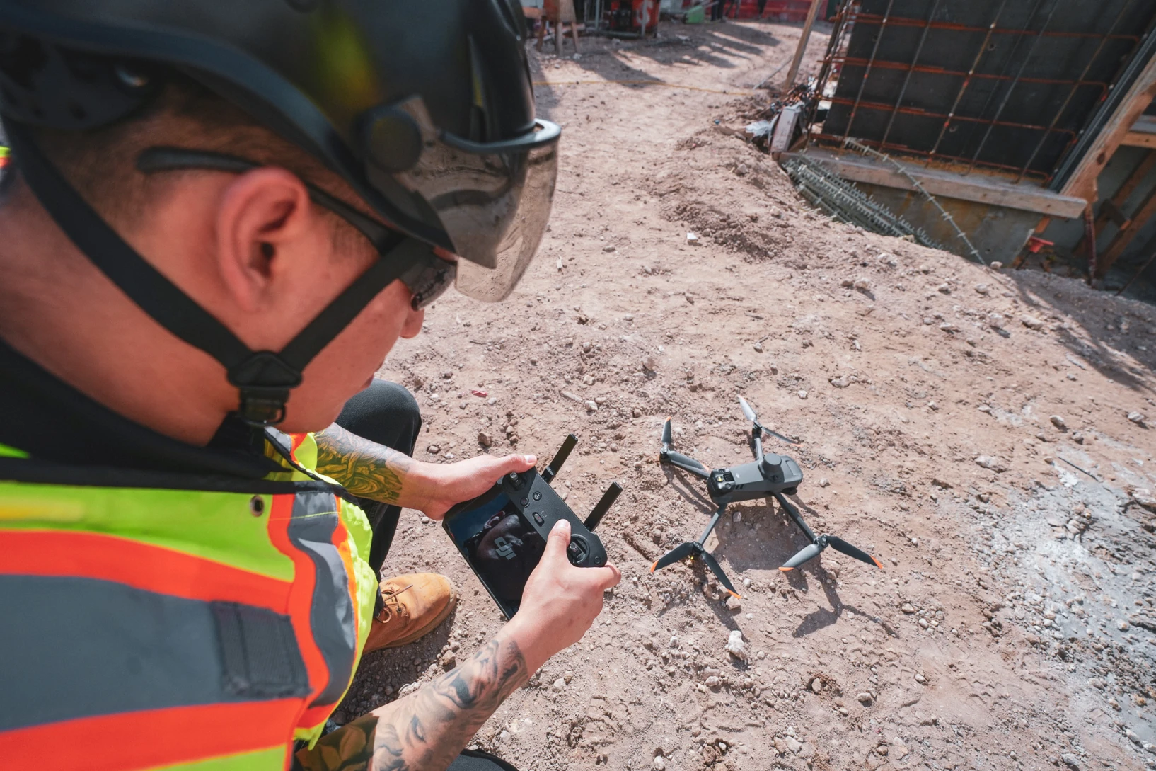
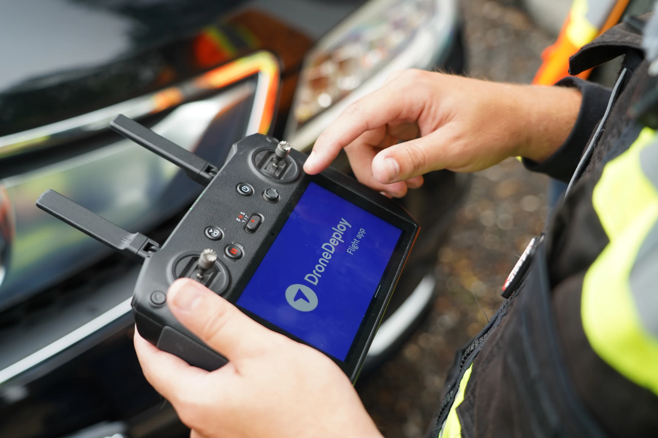
Modern unified platforms like DroneDeploy combine aerial drone imagery, ground-based 360° cameras and autonomous robotics for comprehensive site documentation from preconstruction through closeout.
Which reality capture tools should you consider?
When uploaded into a reality capture software, all of the below technologies can create a digital representation of an object or environment – otherwise known as a digital twin. There is no right or wrong way to capture reality either, as the tool or method you choose will depend on what you’re trying to digitize.
Curious about how to start capturing? Download our photo documentation SOP guide.
Key technologies in reality capture systems
Reality capture uses complementary technologies that work together for comprehensive digital site records:
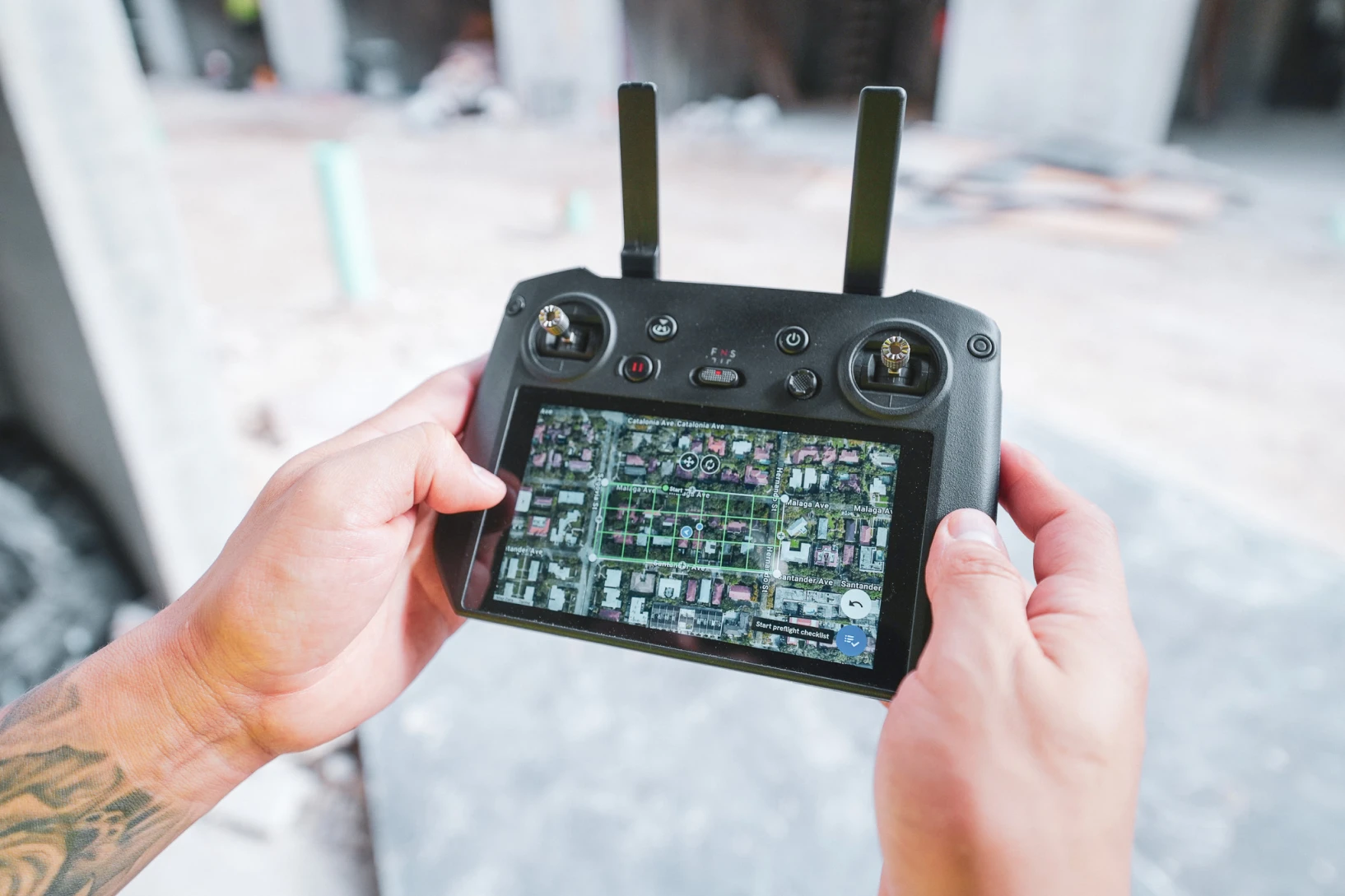
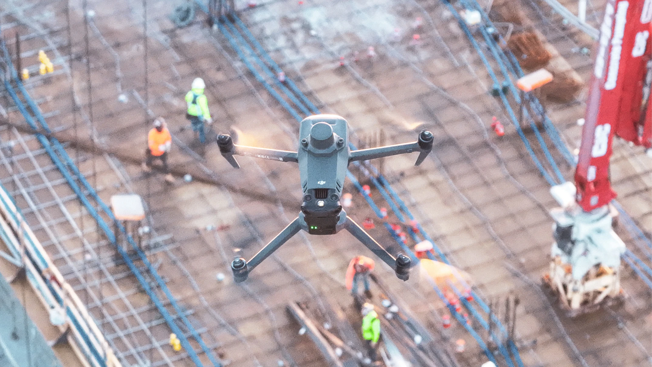
- Drone photogrammetry captures aerial imagery processed into orthomosaic maps and 3D models for comprehensive site overviews
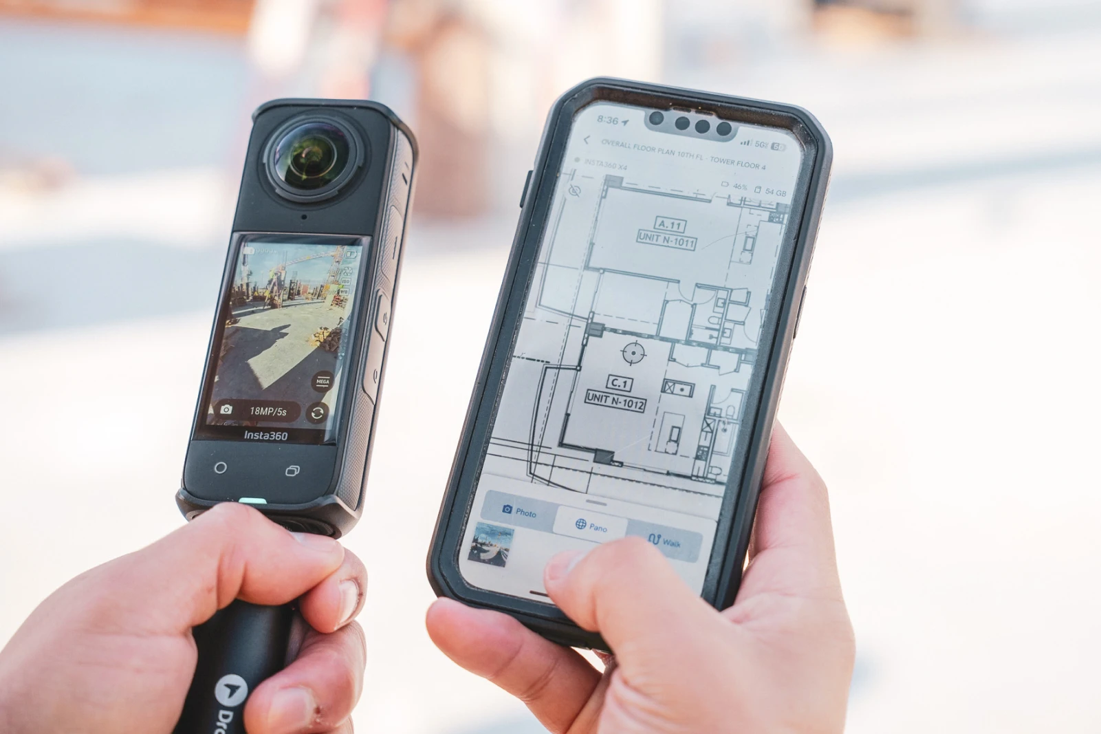
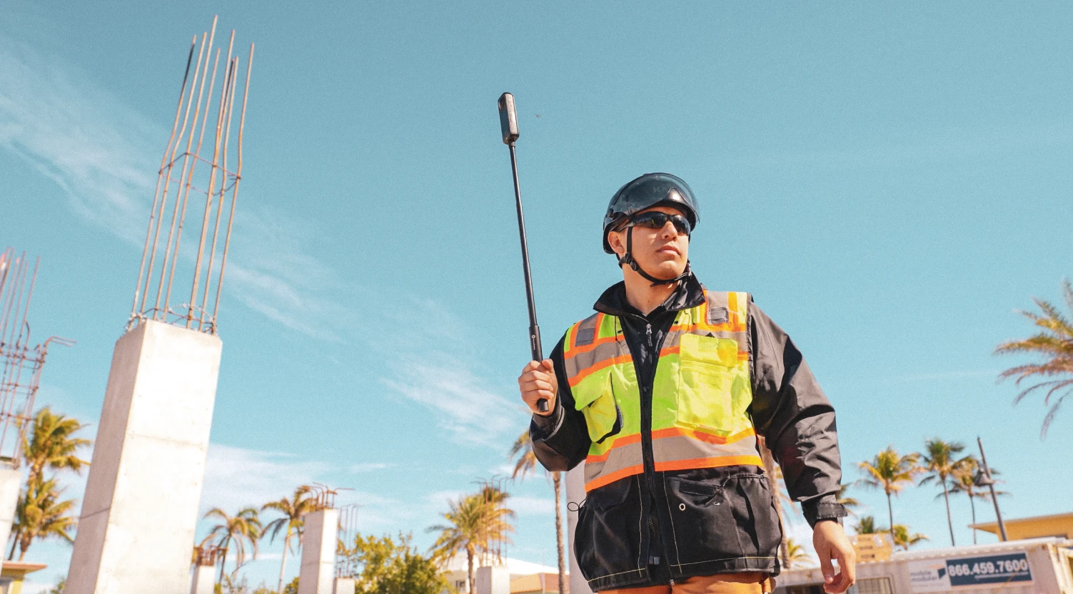
- 360-degree cameras document interior and exterior conditions through immersive walkthroughs that provide complete environmental context
- LiDAR scanning and laser scanning systems generate precise point clouds for millimeter-accurate measurements and detailed geometric analysis
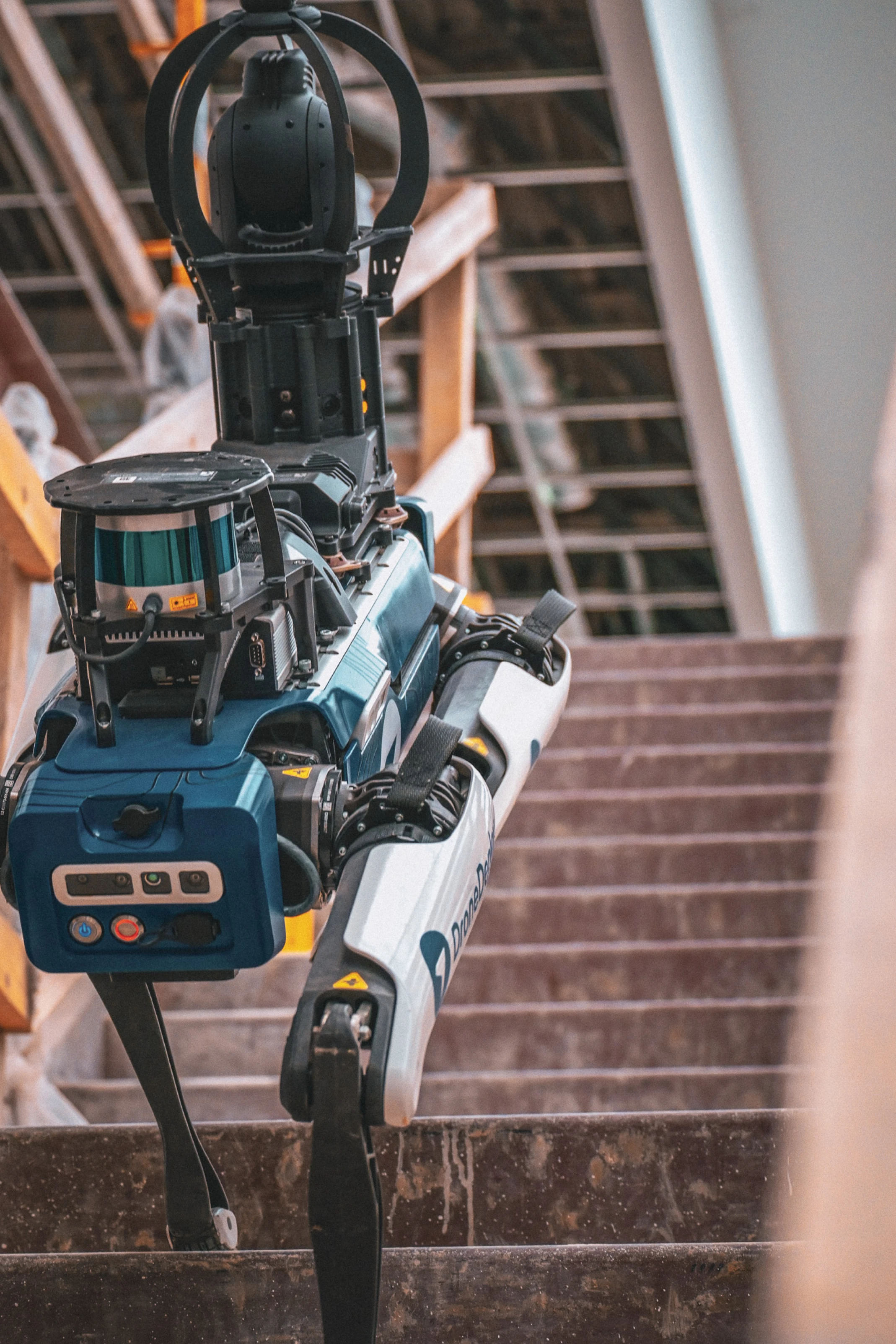
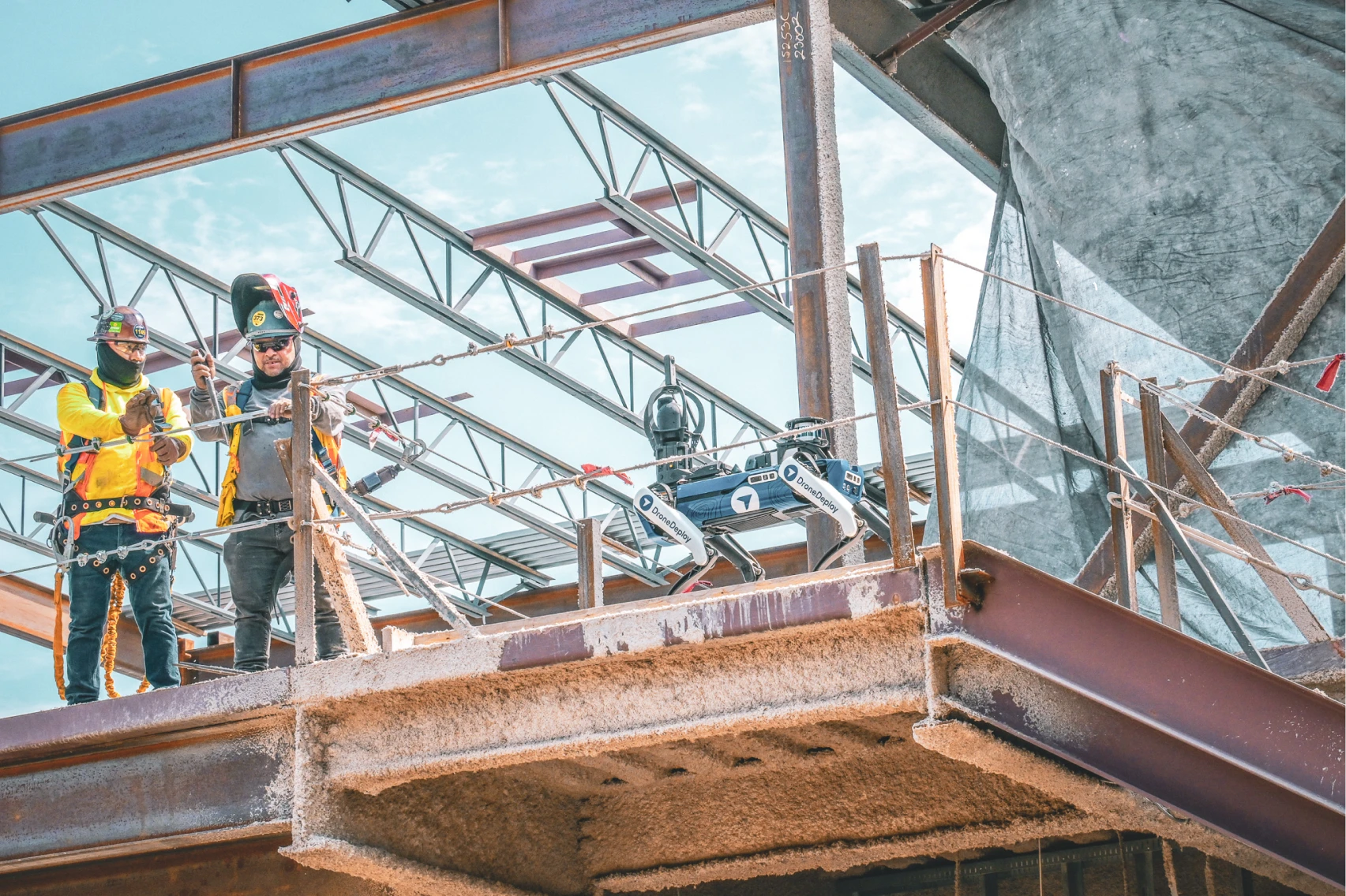
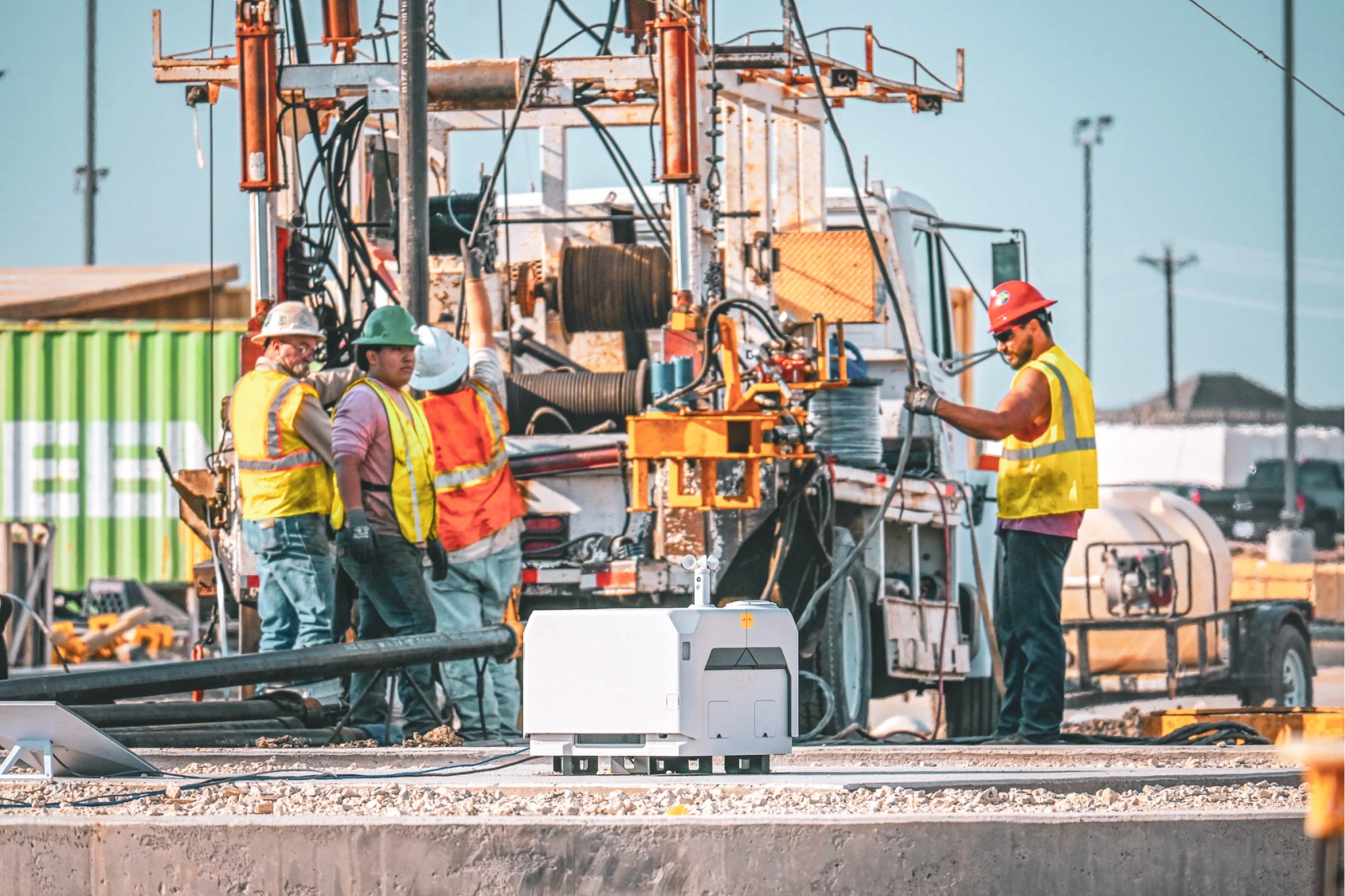
- Ground robotics automate data collection in hazardous or hard-to-reach areas, reducing safety risks and improving coverage consistency
- Thermal sensors detect heat signatures for building envelope analysis and equipment monitoring across energy and industrial applications
- Photogrammetry software processes collected imagery into detailed 3D meshes and textured models for analysis and measurement
Reality capture vs traditional site documentation
Traditional construction documentation relies on manual photography, paper-based progress reports and periodic surveying that creates visibility gaps. A typical facade inspection using traditional methods requires multiple workers on swing stages over several days, creating safety risks and significant labor costs.
Reality capture transforms this workflow into a single drone flight that completes the same inspection in hours instead of days. The digital data gives stakeholders detailed visual records, accurate measurements and virtual inspection capability from any location.
Precision and accuracy advantages
Reality capture technology delivers rapid and precise capture of physical environments, resulting in highly detailed and accurate digital models. Survey-grade scanners and 3D laser scanning systems achieve millimeter-level accuracy, while photogrammetry-based solutions provide sufficient precision for most construction quality control applications. Point cloud data generated from these systems creates comprehensive geometric records of existing conditions.
Learn all about how to achieve high-accuracy in DroneDeploy.
The technology eliminates human error typical in traditional surveying and inspections. Construction firms using reality capture report significant reductions in as-built modeling time while improving accuracy through automated data processing and measurement tools.
Integration with project management software
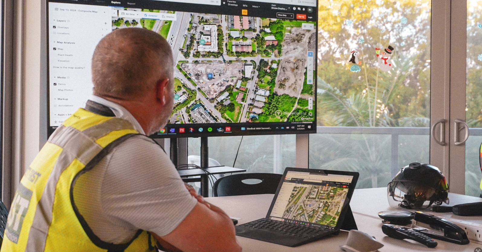
Modern reality capture platforms integrate seamlessly with construction management systems including Procore, Autodesk Construction Cloud and BIM 360. Field data flows directly into project workflows, supporting real-time decision-making and progress tracking.
DroneDeploy's platform offers extensive integrations and APIs that connect reality capture data with existing construction technology stacks. Project teams overlay design drawings onto current site conditions, compare progress against schedules and generate automated reports for stakeholder meetings.
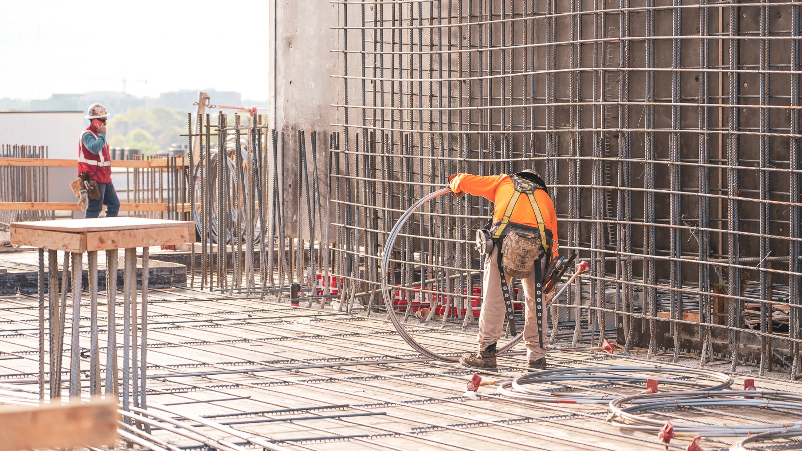
Construction applications of reality capture
Reality capture technology supports critical construction workflows across the entire project lifecycle, from initial site surveys through final handover documentation. These digital documentation methods provide comprehensive visual records that support quality control, progress tracking and stakeholder communication throughout all phases of construction.
Photo documentation and progress tracking
Reality capture serves as the foundation for comprehensive photo documentation, capturing images and data that represent construction state at specific points in time. Modern platforms automatically organize thousands of images by location and date, creating searchable databases of project history that support detailed site documentation workflows.
Construction teams use these visual records during Owner-Architect-Contractor meetings to discuss project status without site visits. The documentation provides evidence for change orders, dispute resolution and quality control verification.
And if you really want to amplify the way you track work on your jobsite, Progress AI automates the process helping you stay atop of changes on your jobsite as they happen. Learn more here.
Quality control and inspections
Reality capture enables systematic quality control by comparing actual construction against design intent. Teams overlay BIM models onto current site conditions to identify deviations, measure tolerances and verify installation accuracy.
Automated inspection workflows detect potential issues early in the construction process. Ground robots equipped with LiDAR scanners perform overnight inspections of data centers, completing in minutes what previously required hours of manual work.
Advanced applications include facade inspections where drones identify cracks, defects and installation issues on building exteriors. MEP verification compares installed systems against design drawings to prevent costly rework, while safety compliance documentation tracks OSHA compliance and identifies potential hazards before incidents occur. Progress validation verifies subcontractor work completion and quality standards throughout the construction process.
Benefits of implementing reality capture
Construction companies implementing reality capture technology report measurable improvements in project efficiency, cost control and safety outcomes. The technology addresses fundamental challenges in construction project management while providing new capabilities for remote collaboration and data-driven decision making.
Time efficiency and cost reduction
Reality capture automates manual tasks such as as-built surveys and quality control inspections, leading to significant time savings and reduced costs. Construction firms report saving substantial man-hours through more accurate documentation and reduced need for rework.
Digital twins and comprehensive BIM models generated via reality capture expedite project initialization and resource allocation. Project teams begin design work immediately using accurate existing conditions data rather than waiting for traditional surveying to complete.
Specific efficiency gains include:
- Substantial reduction in site visit time through automated mission planning and data collection
- Faster as-built modeling using photogrammetry and point cloud processing
- Dramatically faster inspections using autonomous ground robots for repetitive tasks
- Elimination of multi-week inspection cycles for complex structures like facades and bridges
Improved team collaboration
Reality capture facilitates collaborative project workflows by providing shared visual references accessible to all stakeholders. Project teams conduct virtual site walks, review progress remotely and coordinate work across multiple disciplines using the same digital platform.
Remote collaboration capabilities proved essential during COVID-19 restrictions when teams needed to maintain project momentum without physical site access. Companies like Leighton Asia used DroneDeploy to provide thousands of employees with remote access to construction sites across the Asia-Pacific region.
Enhanced collaboration features include virtual site walks for stakeholders who cannot visit in person, real-time progress sharing with automated update notifications, cross-disciplinary coordination using shared 3D models and annotations, and client communication through visual progress reports and virtual tours.
Enhanced data management
Effective reality capture implementation requires centralized data management solutions that support multiple users and ensure version control. Cloud-based platforms provide scalability for processing thousands of images while maintaining real-time access to current project data. Modern site documentation systems must handle large volumes of visual data while providing fast access to critical project information.
Modern reality capture platforms integrate data from diverse hardware devices including terrestrial laser scanners, mobile mapping systems and drone cameras. This unified approach eliminates data silos and provides comprehensive project visibility through a single interface. The integration of various scanning technologies and photogrammetry methods creates a complete digital record of construction progress.
Reality capture technology comparison
Understanding the capabilities and limitations of different reality capture technologies helps construction teams select appropriate tools for specific applications and project requirements.
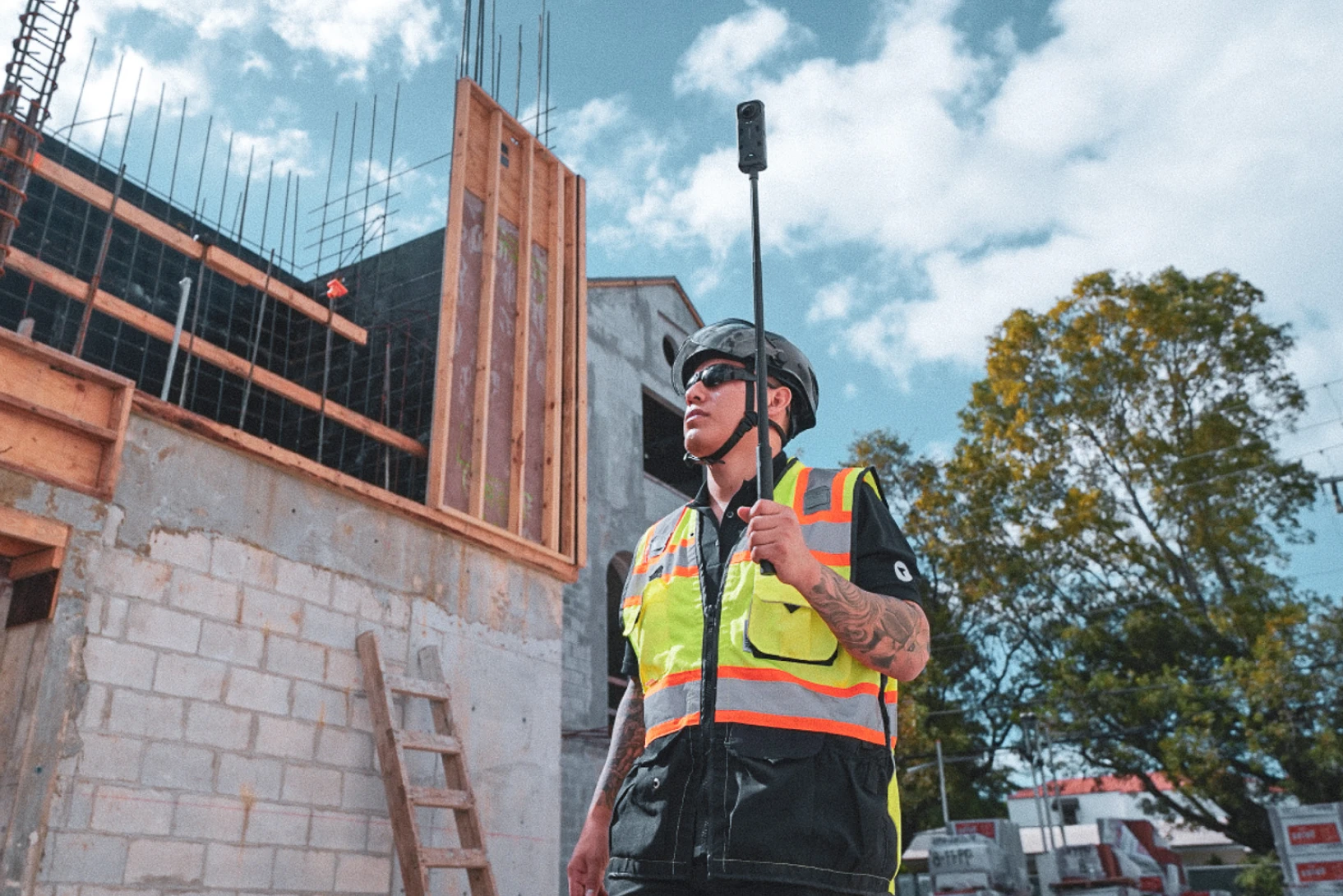
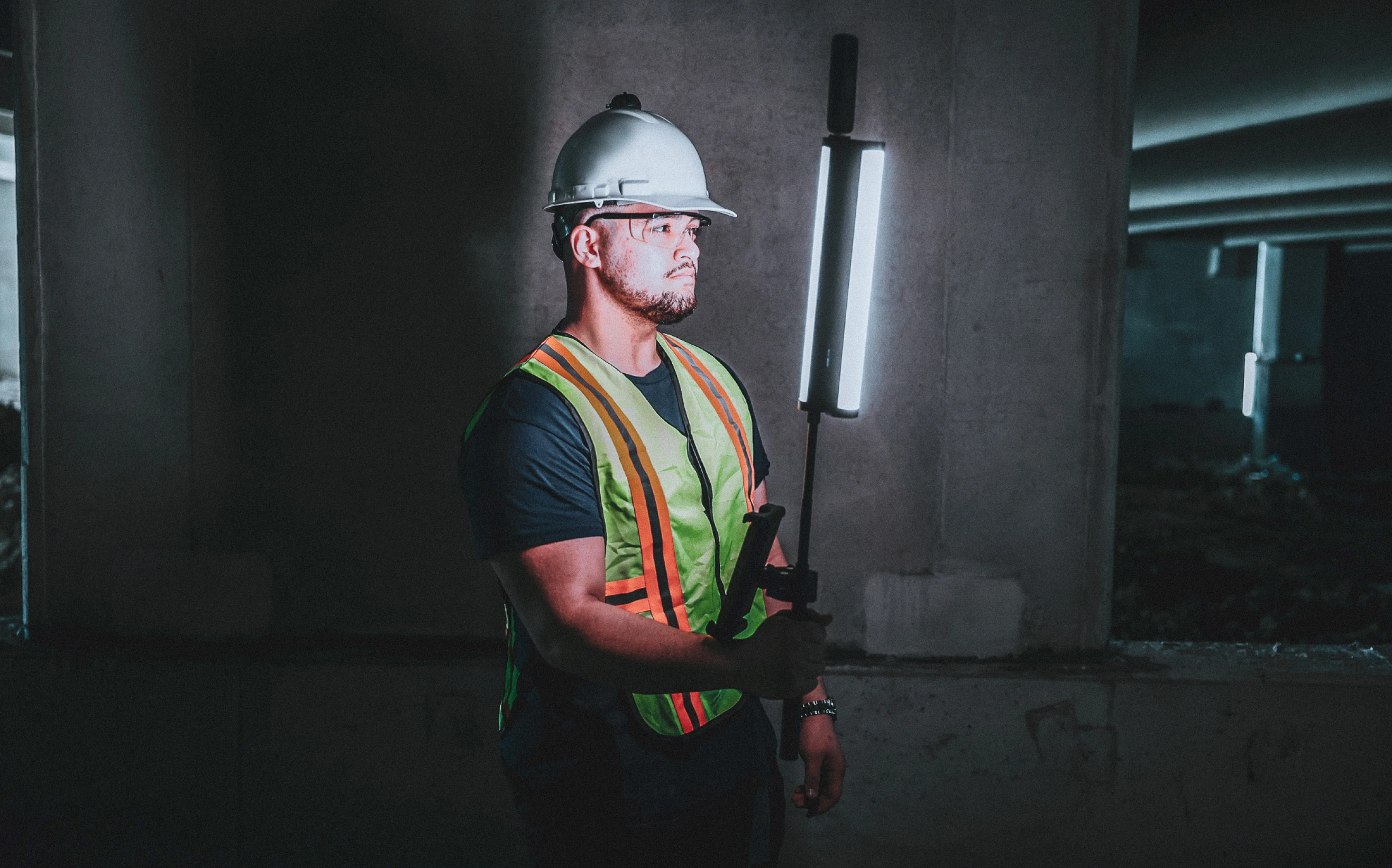
360-degree cameras
360-degree cameras provide the most cost-effective entry point into reality capture technology. These devices capture comprehensive visual records of interior and exterior spaces using multiple lenses to create immersive walkthroughs.
Modern 360° camera systems like those integrated with DroneDeploy's platform automatically organize photos by location and date. Workers can wear cameras during routine site walks to create comprehensive documentation without additional effort or specialized training.
Key advantages include fast deployment with minimal setup time and training requirements, cost-effective hardware compared to LiDAR systems, comprehensive coverage with full 360° field of view that captures complete environments, and easy integration that works with standard construction workflows and existing tools. Limitations include reduced measurement accuracy compared to survey-grade equipment and potential stitching issues in complex environments with limited lighting.
Get started with reality capture hardware here.
LiDAR technology
LiDAR systems use laser pulses to generate detailed 3D point clouds with millimeter-level accuracy. This technology excels at capturing precise geometric data for applications requiring exact measurements and detailed analysis. The resulting point cloud data provides comprehensive spatial information for engineering calculations and design verification.
Modern LiDAR scanners can penetrate vegetation and other obstructions to reveal underlying structures, making them valuable for site surveying and infrastructure inspection. The technology generates photorealistic visualizations while maintaining survey-grade accuracy for engineering applications. Laser scans provide detailed geometric information that supports precise measurement and analysis workflows.
Professional applications include structural analysis with precise measurements for load calculations and retrofit planning, volume calculations for accurate earthwork and material quantity measurements, deformation monitoring to track structural movement over time with millimeter precision, and as-built verification to compare constructed elements against design specifications.
Survey-grade scanners
Survey-grade scanners represent the highest accuracy tier of reality capture technology, delivering dense point cloud data essential for architectural precision. These systems typically range from moderate to high investment levels depending on features and accuracy specifications.
The scanning process requires more time than photogrammetry-based solutions, with scanning cycles taking several minutes per position. However, the exceptional accuracy makes survey-grade scanners suitable for applications requiring extreme precision and detailed analysis.
Construction teams typically deploy survey-grade scanners for historic preservation to document existing structures with museum-quality precision, structural engineering to provide data for complex load analysis and retrofit design, legal documentation to create court-admissible records of existing conditions, and quality assurance to verify installation accuracy for critical building systems.
Overcoming reality capture implementation challenges
Successful reality capture deployment requires addressing common technical and organizational challenges that can impact project outcomes and return on investment.
Technology integration strategies
Integrating reality capture into existing construction workflows requires careful planning to ensure compatibility with current software systems and data management processes. Teams should prioritize platforms that offer seamless integration with popular construction technologies like Autodesk Construction Cloud, Procore and Revit.
Effective integration strategies include API connectivity to ensure reality capture data flows automatically into project management systems, file format compatibility to verify that captured data works with existing CAD and BIM software, workflow automation to reduce manual data transfers through automated processing and reporting, and user training to develop competency in reality capture tools across project teams.
Data management best practices
Reality capture projects generate large volumes of data that require structured management approaches to maintain accessibility and version control. Successful implementation depends on establishing clear protocols for data collection, processing and distribution.
Essential data management practices include centralized storage using cloud-based platforms for secure multi-user access, standardized naming with consistent file naming conventions across projects, version control to track data updates and maintain audit trails for project documentation, and access permissions to control data visibility based on project roles and security requirements.
Training and skill development
Reality capture technology requires new skills and knowledge that may not exist within current construction teams. Successful implementation includes comprehensive training programs that address both technical operation and strategic application of reality capture data.
DroneDeploy offers industry-specific certification programs including Certified Pilot, Certified Analyst and Certified Administrator tracks. These programs ensure teams understand safety protocols, operational procedures and data analysis techniques specific to construction applications.
Choosing the right reality capture solution
Selecting appropriate reality capture technology requires evaluating project needs, budget constraints and integration requirements to ensure optimal return on investment and operational efficiency.
Assessing project requirements
Project assessment should consider the balance between capture speed, accuracy requirements and budget constraints. Different applications require different levels of precision and data density to support effective decision-making.
Key evaluation criteria include:
- Accuracy needs: Determine whether photogrammetry or survey-grade scanning is required
- Coverage requirements: Assess whether aerial, ground or combined capture approaches are needed
- Timeline constraints: Balance capture speed against data quality requirements
- Integration needs: Ensure compatibility with existing project management systems
Unified platform advantages
DroneDeploy's unified reality capture platform addresses the challenge of multiple point solutions by providing integrated aerial, ground and robotic data collection through a single interface. This approach eliminates the time loss that many construction firms identify as a major pain point when using multiple reality capture tools.
The unified platform approach delivers several competitive advantages including a single source of truth where all project stakeholders access the same data through one platform, reduced training overhead as teams learn one system instead of multiple specialized tools, streamlined workflows with automated data processing and integration across capture methods, and comprehensive coverage where aerial drones, ground cameras and robots work together seamlessly.
Implementation timeline and ROI expectations
Reality capture implementation typically shows positive ROI within the first few projects as teams develop proficiency with the technology and establish efficient workflows. Construction firms report immediate benefits in documentation quality and stakeholder communication, with efficiency gains improving over time.
Expected implementation phases include initial training and pilot project setup during the first two weeks, workflow integration and process refinement in weeks three and four, team proficiency development and expanded use cases in months two and three, and advanced applications with automated workflows after month four.
Construction companies using DroneDeploy's unified platform report substantial time savings on typical projects, translating to meaningful cost reductions through improved efficiency and reduced rework.
The future of reality capture in construction
Reality capture technology continues advancing rapidly with artificial intelligence, automated analysis and predictive analytics transforming how construction teams use digital site data for project management and quality control.
Modern platforms like DroneDeploy are incorporating AI into every aspect of the analysis product to replace entire workflows and automate tedious tasks. These capabilities will enable construction teams to focus on high-value decision-making while technology handles routine data collection and processing.
Construction superintendents ready to implement reality capture should evaluate unified platforms that combine multiple capture methods, integrate with existing project management systems and provide comprehensive training and support resources. The technology has moved beyond early adoption to become essential infrastructure for competitive construction operations.
Want to learn more about reality capture? Get in touch.
.png)
FAQ


.jpg)
Ready to manage your data from the very start?
Book a quick call to see how DroneDeploy streamlines capture from construction through building ROI.