The unified reality capture platform that scales with you
One platform for every site, every inspection, every phase – from data centers to solar farms to multi-phase builds.


.png)


.png)


.png)
.png)

.png)
%201%20(2).png)
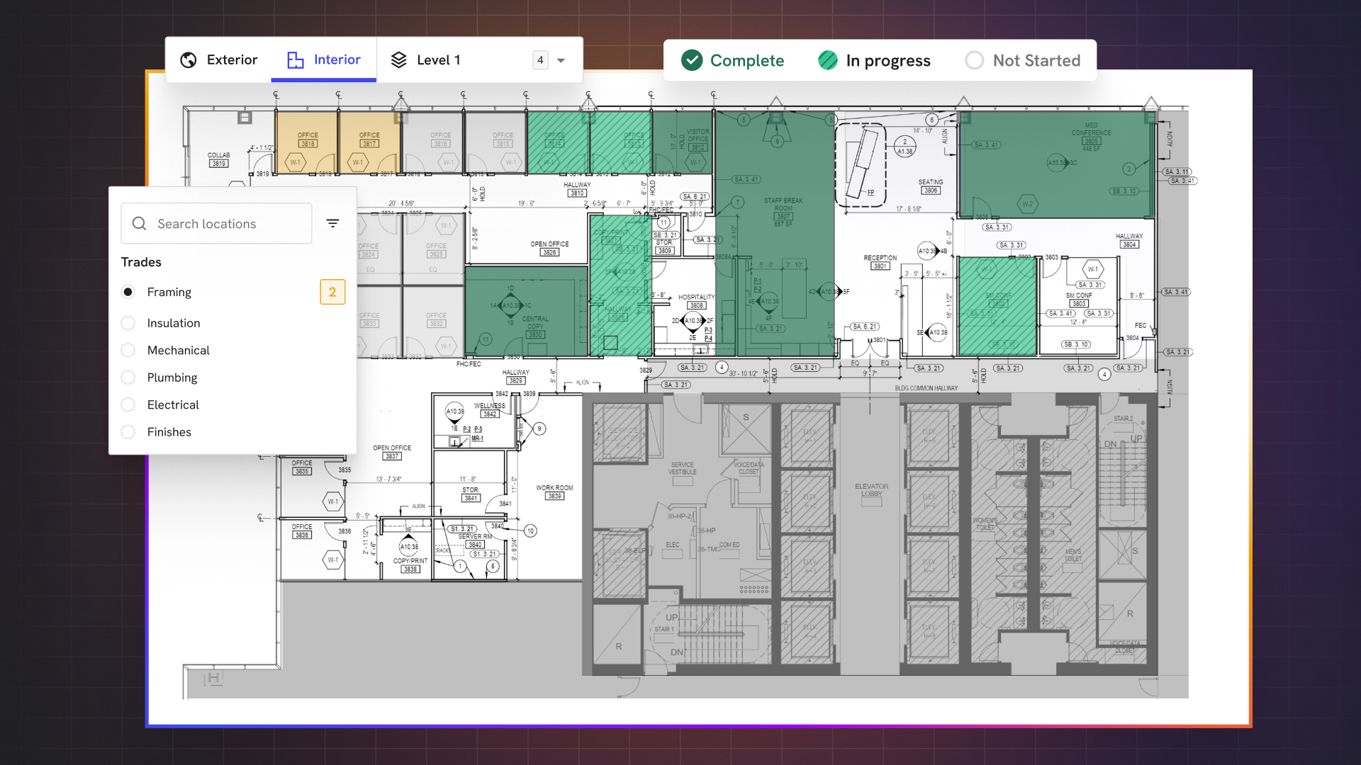
DroneDeploy Unified Plan
Document your sites from every angle with drones, robots, 360 cameras, fixed cameras and smartphones all in one AI-powered platform.

DroneDeploy Aerial Pro
Get more from your drone program with survey-grade data – automated, verified and built to scale.
Optimize processing time and accuracy for complex sites
Automate GCP tagging and save hours per map
Know when there’s a problem with in-app accuracy alerts and expert map review
Analyze earthworks cut/fill by region, export quantities and track progress to design
DroneDeploy Aerial
Fly commercial drones, capture and organize photos, generate maps and inspection reports, and share easily.
Automate aerial capture, including docked drones with Flight app
Document your site with hi-res orthos, 3D models, panos and videos
Overlay designs, validate installs and tag issues on-site
Export and sync data instantly with Esri, Autodesk and Procore

DroneDeploy Ground Pro Beta - Coming soon
Move from 2D to 3D documentation, capture on everyday devices and share instantly.
Capture mobile 3D scans on iPhone/iPad with LiDAR and RTK
Measure from 360 Walks with interactive 3D model views
Upload 3D laser scans (including .e57 and .PLY LiDAR) and view alongside 360 and aerial imagery
Leverage the latest 8K high-resolution data for 360 Walks
DroneDeploy Ground
Walk sites with 360 cameras, organize photos, overlay maps onto floor plans, compare conditions to BIM and share reports.
360 Walks for progress tracking and dispute protection
BIM and drawing overlays to catch layout issues early
Seamless sync with Procore, Autodesk and fixed camera feeds
Safety AI for automatic OSHA risk detection and compliance
Autonomous robotics for remote site management
Just need one seat? View our Individual Pilot and Ag Lite plans here

Flight & Analysis Plan
Individual Pilots
Billed annually
Single admin user license
Upload up to 3,000 images per map*
Access to email and live chat support
Ground capture processing not included
Ag Lite Plan
Agriculture Pilots
Billed annually
Single pilot license
Upload up to 1,000 images per map*
Stand Count analysis (Corn V2/V3 and Soybeans)
Live Map for real-time, field-edge crop scouting
RGB Plant Health (VARI index only)
Email-based support
Advanced Flight & Analysis Plan
Individual Pilots
Let's talk
10k image upload per map*
Cut / Fill vs. Design Surface
Vertical Facade Inspection
Radiometric Thermal
Unlimited GCP Mapping*
Email & Chat Support
Ground capture processing not included
Supercharge your teams with platform add-ons
Enhance your reality capture workflows with domain-specific AI, terrain-specific robotics and industry-leading security and integrations.

.svg)
Turn your interior 360 walkthroughs and aerial imagery into actionable, reliable progress reports using jobsite-trained AI – no 3D model requirements, just better documentation and project management.
Learn More
Fortify your safety program, detect OSHA safety risks and lower your insurance premiums and EMR with real-time analysis and automated reporting – zero setup or training required.
Learn more

Schedule autonomous docked drone flights to create a visual twin of your environment from the air with the most secure dock automation solution available.
Learn more

Automate your ground inspections with robots to understand the condition of your assets, track changes over time and take action on issues before they become costly outages.
Learn more

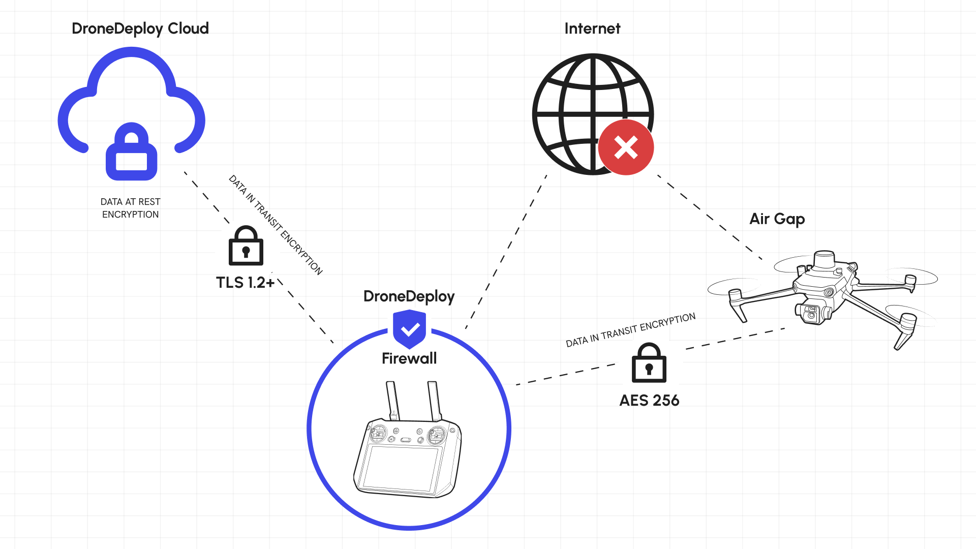
Prevent cyber attacks on your drone. Stop data egress to anywhere but its intended destination with the world’s first security firewall for commercial drone hardware.
Learn more
Built for the field.
Trusted in the boardroom.
Replace siloed tools with one system that captures, processes and shares site data – from the air to the ground at every phase.

Capture with drones, robots, fixed and 360 cameras, as well as smartphones – managed in one platform.

ISO 27001, SOC 2 Type 2 and NIST 800-53 compliant – DroneDeploy is built for enterprise IT.

No pilots? No hardware? No problem. With our network of professional service providers, you’ll get value from DroneDeploy from day zero.

Our industry-tuned AI tools scale your aerial and ground site documentation without scaling headcount.

Create georeferenced maps with design overlays, volume checks and earthwork validation at survey-grade accuracy.

Docked drone flights and ground robotic walkthroughs or inspections mean you can finally digitize your sites and assets without (always) needing to be physically on-site.

Fuse DroneDeploy project and activity data with your proprietary internal data to generate new insights and actionable intelligence.

Share data with Procore, Autodesk Build, BIM 360, Esri, OneDrive, Azure, Egnyte, Google Drive, Sharepoint, Amazon S3 and Box.
Still have questions?
Let’s talk through your use case and find the right fit for your team.

Less is more. The less logins you have, the less software you have to deal with, the less places to go. Having ground and aerial in one place is definitely more for us.
.png)

Yes. Every new user gets a 14-day free trial – no credit card required.
We accept all major credit and debit cards: Visa, MasterCard, American Express, Discover and Diners Club. All charges are in USD.
Yes. Verified nonprofits and educational institutions are eligible for discounted pricing. Apply at DroneDeploy.org.
Yes. You can upgrade, downgrade or cancel anytime in your Account Settings. Changes take effect at the end of your current billing cycle.
No. Individual license users can choose between monthly or annual billing when subscribing. Annual plans offer savings over month-to-month pricing.
You’ll retain basic access for 30 days. During that time, you can view existing maps, models and 360 Walks, but export and advanced tools are disabled. Reactivating a plan restores full access and removes the expiration date. Be sure to export any needed data before the 30-day period ends.
Yes. You can subscribe to Aerial (drone) or Ground (360/smartphone) capture on their own – or get full value with our Unified plan, which includes both.
Yes. Fair use limits apply depending on your plan tier. Review full details in our Fair Usage Policy.
Absolutely. We’re SOC 2 Type 2 and ISO 27001 certified, with data encryption in transit and at rest. Enterprise customers can enable SSO and role-based access controls.
DroneDeploy is designed for field, operations and VDC teams – not just tech pros. Our simple user interface, no-code workflows, automated capture and AI insights make it easy for anyone to use.
Yes. DroneDeploy integrates directly with platforms like Procore, Autodesk BIM 360, Esri, Box, SharePoint and more.
No problem! We have plans for individual pilots and agriculture users. View plans here
Getting started is simple. Ask us for a custom quote today.

.png)