Agriculture

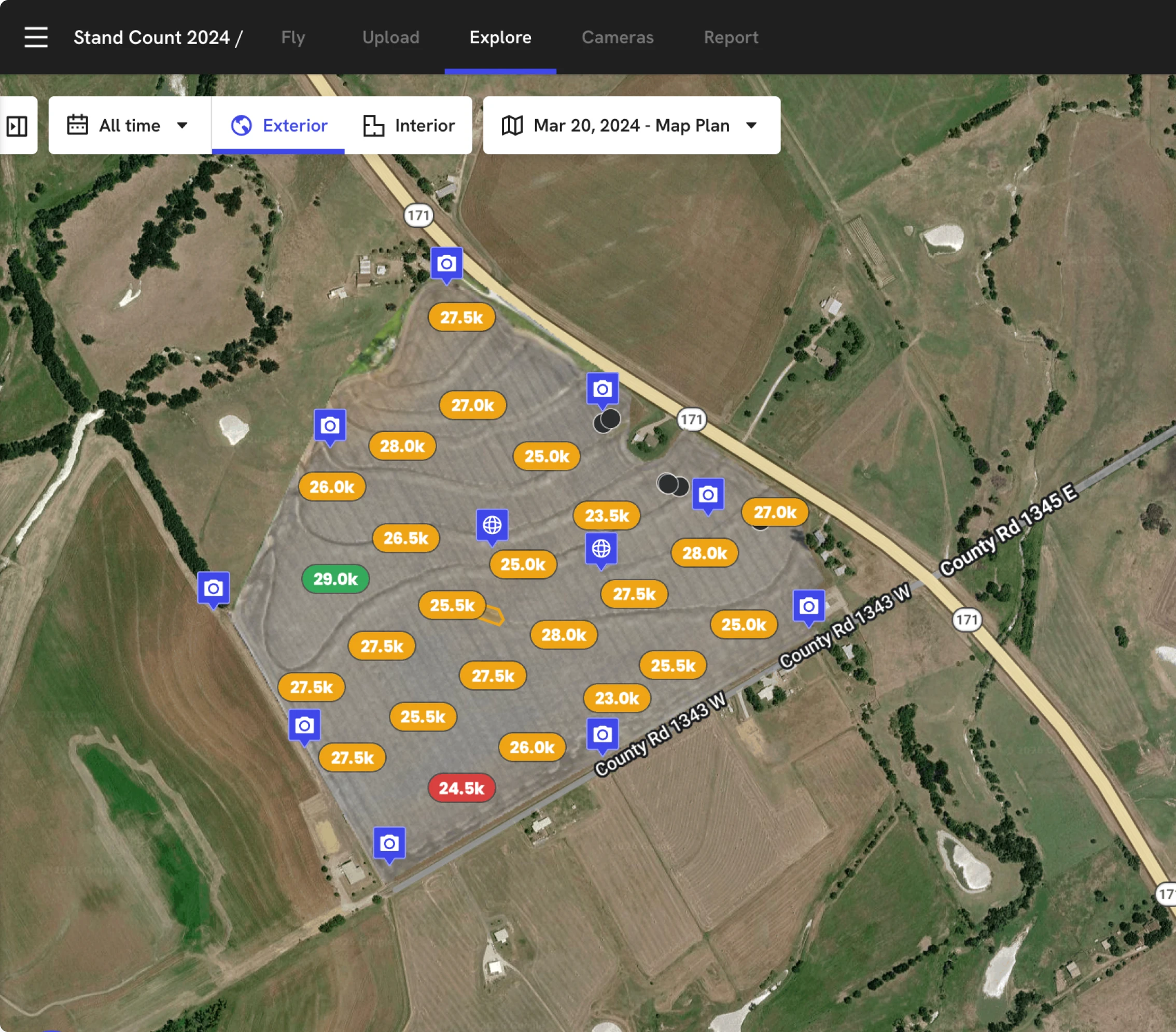
Get a field-wide view of every acre

Capture high-resolution, agronomy-ready maps of every field so you can share issues early, document plant emergence and optimize every input across the season – all at the field edge.  
Used on 400k fields in 130 countries

Field edge analysis to protect yield on every acre

Field documentation

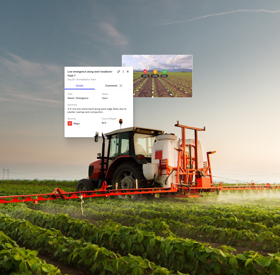
Capture what matters before it’s covered

Give agronomists, growers, and insurers timestamped maps and stand counts so claims and payouts rely on objective proof.
Remote visibility

Highlight stress before your scouts can

Use NDVI and RGB plant‑health layers to spot pest, disease, irrigation and fertilizer stress before it spreads.
Schedule & input planning

Precision ag so every acre delivers.

Use zones, indices and stand counts to guide planting, spraying, fertilizer and replant decisions by response and risk.

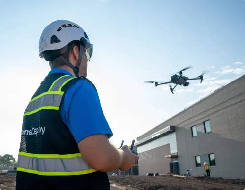
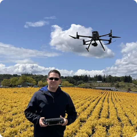
Capture every acre from the air

DroneDeploy Aerial

Field-wide crop insight in every flight
Map every acre fast with automated flights
Produce agronomy‑ready crop maps, stand counts and drainage models
Spot crop stress early with NDVI and other plant‑health indices
Create management zones and export VRA shapefiles
Mark issues, measure impacted acres, share with partners

DroneDeploy Ground

Crop insight from the field edge
Use 360 capture and mobile to scout rows up close
Run early‑season stand counts over hundreds of acres in minutes
Capture notes, photos, and observations directly on the field map
Work offline at the field edge; sync when you’re connected
Share clear scouting reports instantly with growers and agronomy teams

Need a full feature list and custom quote?

Supported hardware

Build your fleet
(or let us do it for you)
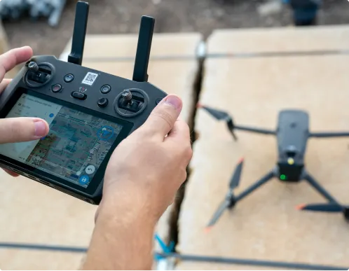
Drones

Our precision agriculture software integrates with leading drone manufacturers so you can generate high-quality, repeatable maps over your fields – from emergence through harvest – with the hardware you already trust.
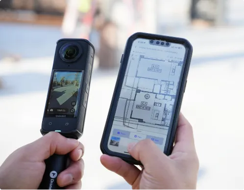
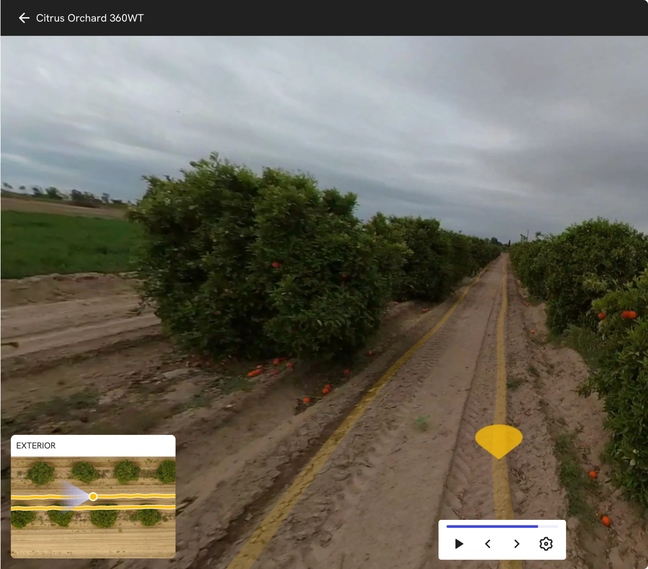
Get the right drone for your use fields

360 cameras

Our field documentation software maps shops, grain sites, storage and livestock facilities with fast 360° walks that give agronomy teams and partners a clear view without extra trips.
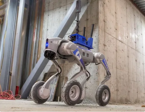
Order a 360 camera kit

Dock automation

Our agriculture drone mapping software supports drone docks to automate repeat flights over key fields and trials, keeping crop health data current all season without rolling a truck.

Get a docked drone on your site

Data on demand

Need the data but don't have pilots or hardware yet? Tap into our professional network to capture your fields at key growth stages – from planting checks to pre-harvest assessments – and have the imagery delivered straight into your DroneDeploy account.

Get your crop data delivered to you
Integrations

Don't just collect data – connect it.

See all 80+ integrations

Stay ahead of every acre.

Understand crop health, variability and performance.
Streamline workflows
Gain ROI on materials
Optimize your yield
Drone data on demand
Pinpoint planter failures
Quantifying wind damage
"DroneDeploy helps us create workflows and processes to improve our inventory, plant health modeling and soil volumetrics."
Jonathan Buswell
Director of Automation
See how
"Our soil piles hold a lot of value. Having a trustworthy way to collect volumetrics to understand what we're purchasing was an instant win."
Jonathan Buswell
Director of Automation
See how
"Decision agronomy tools like DroneDeploy enable our agronomists and contract seed growers to make timely decisions impacting seed yields and quality.”
Matt Kurtz
North America Seed Production & Supply Chain Director
See how
"We would not have a drone program if it weren’t for DroneDeploy’s Flight Services."
John Dougherty
Vice President of Maintenance Sales
See how
"Drones get down to a single row. I can understand I have a problem with row 11 on my planter and fix it."
Ken O'Brien
Agronomy Innovation Leader
See how
"Being able to capture data without putting people in the line of fire is huge."
Ken O'Brien
Agronomy Innovation Leader
See how
Frequently asked questions

Is DroneDeploy the right fit
 for your operations?

Do I need to be a drone expert or agronomist to use DroneDeploy?

No – DroneDeploy is built so anyone on your team can capture and use aerial data. Our onboarding resources cover everything from pre-flight checklists and “zero to hero” training to beginner and intermediate webinars, so you can go from first flight to usable field maps quickly.

What kind of agriculture-specific insights can I get from my maps?

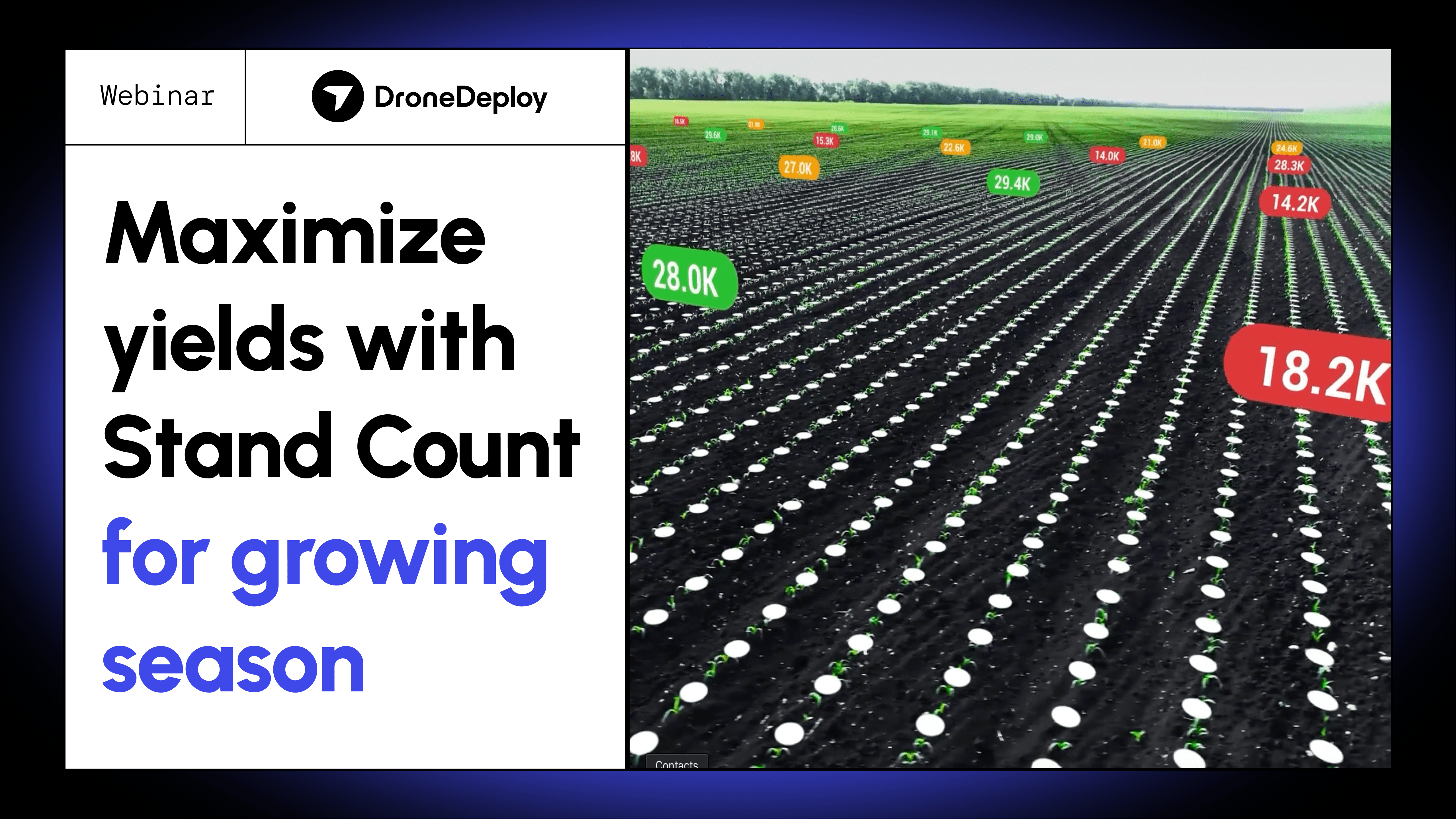
DroneDeploy helps you move beyond pretty pictures to agronomic decisions. Start with emergence-level stand counts to understand how your season is taking shape, then seamlessly transition into plant health analysis to catch stress early, protect yield, and guide smarter in-season decisions across every acre.

Can I use the drones I already own, like a DJI Mavic 3E, 4E or Air2S?

Yes. DroneDeploy supports popular DJI platforms used in agriculture and provides workflows for mapping large areas and working with multispectral and modified NDVI cameras, so you can get more value from the hardware you already have.

How does DroneDeploy fit into my existing precision ag and farm management tools?

You can export zones and shapefiles and send your data into platforms like Climate FieldView and ESRI via the DroneDeploy App Market, so field insights flow directly into the tools you use for prescriptions and reporting.

Is this only for large, enterprise-scale farms?

No. DroneDeploy is used by individual growers, custom applicators, ag retailers, and enterprise operations alike. If reducing input waste, protecting yield, or documenting crop conditions for partners and insurers matters to your business, DroneDeploy can help.

What kind of ROI have other growers seen?

Results vary by operation, but customers have documented six-figure gains from using drone imagery to validate conditions and make more informed decisions – for example, Gregg Heath of Silicon Falcon Micro Aviation helped a tobacco farmer recoup an additional $110,000 from his damaged crops using DroneDeploy.

Getting started is simple. Request a demo today.

Book a demo